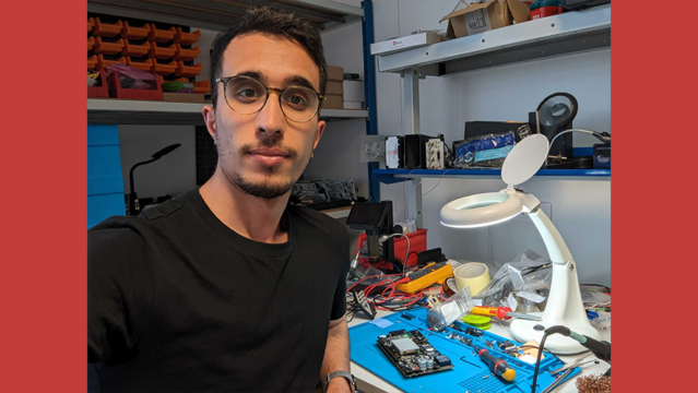
Focus on collaborator: Belaid Ben-Lalli
07.21.23
Proud to introduce our young engineer in electronics, IT and telecoms development. It all started for Belaid with an internship...
Read more


Geoflex had the pleasure to interview with Frédéric Auger, Chief Surveyor at TotalEnergies who explained us the needs for high accuracy positioning in the offshore oil and gas business and how Geoflex’s technology is meeting TotalEnergies surveying requirements.
Watch the video below
Hello, I am Frédéric Auger, and I am Chief Surveyor and expert in geodesy and positioning for TOTALENERGIES. As such I supervise all positioning operations involving GNSS for our exploration & production activities around the world.
I’m also the chairman of the GEOMATICS committee of the IOGP (International Association of oil & gas producers). The GEOMATICS committee include all my counterparts from other operators like BP, SHELL, or EXXON. This role of chairman is covered alternatively by one of us for 3 years. Geomatics is the combined discipline of Survey & Positioning and Geospatial Data Management and provides accurate positioning and mapping support across the full Oil and Gas life cycle.
What can you tell us about TotalEnergies in general and your operations offshore?
Total has very recently changed its name to TotalEnergies, in order to affirm our identity as a broad energy company and confirme our ambition to be a major player in the energy transition, on the road to net zero. While TotalEnergies will sell more and more electricity in the next decades, we will still develop oil and gas fields in order to help meet global energy demand while reducing greenhouse gas emissions associated with the production of hydrocarbons. In order to ensure the coherence of its business with the challenges posed by climate change, Exploration and Production targets low-cost, low-breakeven and low-carbon oil projects while continuing to expand its natural gas production. Most of these projects are offshore and mainly deep offshore.
For each project we need a precise positioning for the drilling but also for the installation of floating or fixed production units as well as for the production units which are installed on the seabed. Interesting to note that offshore wind farms for instance, will also require precise positioning, so that our activity will also develop with TotalEnergies’ new ambition!
What his the role of Chief Surveyor in a company such as TotalEnergies?
First of all, you need to understand that an error in the definition of the geodesy and in the validation of the coordinates can have significant financial impacts (several millions of Euros in the case of a drilling or a seismic for example) as well as consequences related to safety and to the environment – example of shallow gas not foreseen in the case of an error in well location, or pollution and risk of major accident in the case of the installation of a jacket above a pipe in production.
My main mission is to provide expertise in geodesy and positioning for all operations at Exploration and Production but soon for other energies such as wind farm for example. The missions are as varied as the installation of geodetic networks on land or at sea, marine or land seismic acquisitions, drilling installations, installations of platforms or underwater structures, underwater metrology by deep sea.
Beyond these operational aspects, the expert is also in charge of keeping up to date our technical referential and to evaluate of requests for deviations from our General Specifications.
In charge also of the technological watch on developments in Positioning, Topography and Geodesy. In particular, The problem of positioning in the Ultra Deep (from 3000 to 6000m). The challenge will be to find innovative solutions to guarantee metric precision at such depths.
Also the advantages of using multi-constellation satellite positioning systems such as GPS, GLONASS, GALILEO, and BEIDOU. Indepndance from the American GPS and Russian GLONASS systems is a major issue.
Also in charge of taking into account dynamic coordinate systems which will be increasingly used and imposed by national authorities. Contribution to the move towards Digital by improving techniques for the acquisition and processing of 3D data by laser scanner or photogrammetry.
I am in charge also to monitor the R&D programs allowing the development of the level of expertise of the specialty.
And finally, representation of TOTALENERGIES within professional associations or national and international congresses and conferences. I’m the Company’s representative in the GEOPOS commission of the CNIG (Conseil National de l’Information géographique) and as explained earlier in the GEOMATICS Committee of the IOGP.
In your off-shore operations what are the specific needs of precise positioning for fixed platforms at sea?
There are 2 different use cases. The first one is horizontal. We need to position the jacket with an accuracy of few centimeters because: it can be used as a starting point for production drilling and therefore it is important to know the position of the well head with the best possible accuracy. It can be interconnected with other platforms by gateways. It can be connected to export pipelines
The second use case is vertical, to monitor the subsidence of the platform. Indeed, the extraction of hydrocarbons from a reservoir causes a decrease in pressure. This drop in pressure will be directly transferred to the surface through the forces exerted on the geological layers and which will therefore produce a deformation. The latter will depend on the geometrical characteristics of the rock and the geology of the area. Knowing that this deformation causes both vertical and horizontal movements, it is therefore necessary to measure it.
Typically what level of positioning accuracy do you require for this use case?
For the horizontal part few centimeters in real time are needed. For the subsidence the vertical accuracy requested is about few centimeters in real-time and could reach few millimeters in post processing.
To answer these specific positioning requirements, what has been the Geoflex solution?
Geoflex has demonstrated the capabilities to monitor the position of the jacket with the Geoflex/CNES PPP (Precise Point Positioning) Technology in real time with an accuracy of 2.7cm, 3.8cm and 5.5cm respectively in East, North and Up components with a confidence level of 95%.
They also demonstrated that using pseudo-static algorithms with observation sessions of 2, 4 and 24 hours, it is possible to confirm the subsidence, or vertical displacement, in near real time with an accuracy of respectively 3.9cm for 2 hours, 2.5cm for 4 hours and 8-millimeter for 24 hours with a confidence level of 95%.
We have demonstrated also that even the vibrations due to the strong winds we may face in North Sea could be measured thanks to the processing proposed by Geoflex.
To conclude, what are your thoughts about Geoflex and the team involved in your project?
The Geoflex team has been very proactive and professional. It is clear that when you discuss with them you face expert on positioning and GNSS. I learned a lot during our collaboration.
I have organized a workshop with my colleagues in our affiliates to present the solutions proposed by Geoflex because I’m convinced that their real-time PPP solution for example, could help us to optimize the cost on our operations offshore.
To conclude I can say that I’m very satisfied with our past collaboration and look forward to working with them in the future.
Proud to introduce our young engineer in electronics, IT and telecoms development. It all started for Belaid with an internship...
Read more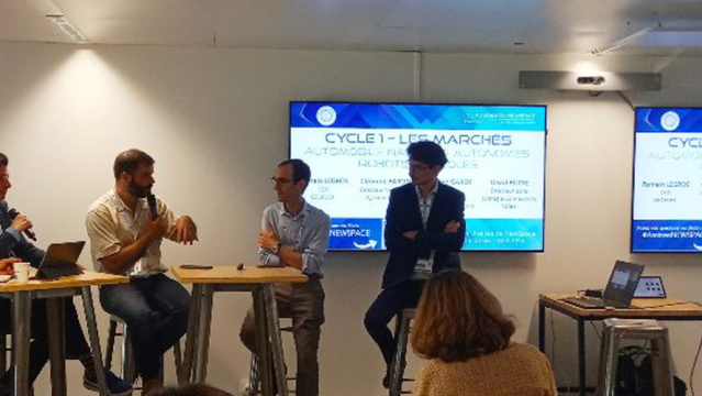
Romain Legros, CEO de Geoflex spoke at the round table dedicated to the market of mobility.
Read more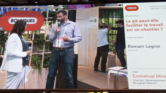
Romain Legros, CEO of Geoflex, spoke at the round table dedicated to the work: Can 5G make work on a construction site easier?
Read more